Saturday, January 25, 2014

Normandy, France


Mont St. Michel
 
The drive to Normandy, France from our house in England took about six hours.  35 minutes of that was sitting in our car as a car-mover train zipped us through the Channel Tunnel, an experience we won’t soon forget!  It’s the fourth way we’ve transported ourselves from England to mainland Europe (the other three being the car ferry, by airplane, and the Eurostar train).  The flexibility of having our car was great and we were even able to take Bailey with her brand new pet passport! 

Sitting in the car, on a train, under the ocean.  Strange!
The Chunnel dropped us off in Calais, France where a heavily tolled series of roads led us along the coast of Normandy.  The forecasted cloudy afternoon instead turned out to a beautifully sunny one so we shuffled plans and detoured for a few hours to Etretat, a tiny town surrounded by white cliffs along the Cote d’Albatre.  This Alabaster Coast is truly Monet’s Normandy and is known as the cradle of impressionism.  Monet lived in the area for years and produced more than 80 canvases of Etretat alone.  I don’t appreciate art to the extent I could, but despite this lack of knowledge really do enjoy Monet’s paintings.  The colors at the cliffs were amazing.  The white limestone was speckled and streaked with reds and browns, the grass was bright green even in the middle of winter, and the Atlantic was such a unique milky turquoise… I’ve never seen anything like it.  Of course we had to hike along the well-worn path along the cliffs.  This meant stairs.  Loads of them.  I think Chris forgets that I’m carrying an extra 20 pounds these days!  The light was beautiful and so was the day.  Our winter really has been mild this year: a light jacket and hat have been all we've needed so far!  We left the beautiful coast at sunset and drove the last couple hours to our hotel near Mont St. Michel. 
Me, belly, Chris, and Bailey with Etretat in the background.
 
Beautiful Cote d'Albatre white chalk cliffs and cloudy turquoise waters.
Mont St. Michel is a fortified abbey perched upon the top of a tiny, steep, rocky island just off the coast of the junction of Normandy and Brittany.  Apparently the narrow cobbled streets are seriously crowded in the summer months but we had the whole place to ourselves at first light on Sunday morning.  The three of us wandered around the (did I mention steep and stair-filled?) island for a couple hours, and then headed back to the car to drive to the D-Day beaches where we’d spend the rest of the day.   

Me and Chris with Mont St. Michel in the background.

Abbey sitting atop the steep, rocky island.

You know how you automatically turn sideways to fit through something narrow??  Yeah, that doesn't work anymore. 
 
It was only a couple hours drive to Utah Beach.  We stopped at a small bakery along the way to get our mandatory-daily-while-in-France chocolate croissant.  In my humble opinion, every country should adopt the chocolate croissant as a staple food.  But yes, on to Utah Beach.  We parked and then walked along the beach to its supposedly excellent visitor center and museum.  Gee, there aren’t any cars here.  And the lights are all off.  And the door is locked.  Face palm, they’re closed the entire months of December and January except for Christmas.  We had definitely missed that memo.  Luckily we prepped for the trip by watching videos on D-Day and brushing up on our history.  I’m so thankful we did that; otherwise we would have just been wandering around a beautiful, peaceful beach.
Bailey was so happy to be out of the car!  This was our first view of the D-Day beaches.
 
 
Chris taking down imaginary Nazi planes.
On June 6, 1944, 6,000 ships and 13,000 Allied airplanes hit the beaches of Normandy, France. The initial landing force was 45,000 men but in the course of a few weeks would swell to 135,000 as Allied troops stormed ashore along Utah, Omaha, Gold, Juno and Sword beaches.  There were 37,000 Allied casualties in the 76-day Battle of Normandy, a number I find absurd. Hitler’s German army had captured just about all of mainland Europe by this point (and had held it for years) and had their sights set on capturing the United Kingdom as well.  Russia was battling Germany on the eastern front, dividing Hitler’s army and leaving just enough of a weakness along the coast for the Allies to capitalize on.  Japan’s bombing of Pearl Harbor galvanized the United States to start up the ‘war machine’ that dragged us from the Great Depression.  Three years later we joined Canada and England in the largest military operation in history, Operation Overlord, and attacked Hitler along the Normandy Coast.  This battle was decidedly the turning of the tide against Hitler – he would be dead within a year.
From Utah Beach we drove a couple miles to Pointe du Hoc, a strategic outcropping of land between Omaha and Utah Beach that held some of Hitler’s major artillery used to defend those beaches. US Rangers captured Pointe du Hoc by scaling the 100’ sheer cliffs from the seaward side. Way more than half the Rangers involved in the attack were killed. Wiki has a great article about the battle: http://en.wikipedia.org/wiki/Pointe_du_Hoc. It was so interesting to walk around the pock-marked, almost lunar landscape and think of the area being shelled from the gun boats below.

Walking around Point du Hoc's lunar landscape.

The cliffs the Army Rangers had to battle their way up, under fire, to capture Ponte du Hoc.
 
Our last stop of the day was a coffee and then sunset at Omaha Beach, the other of the US’s main landing beaches.  I won’t do the battle justice in my own words on this blog, but would really suggest watching a video on the battle. 


Les Braves Monument on Omaha Beach

The Wings of Hope
So that the spirit which carried these men on 6th June 1944, continues to inspire us, reminding us that together it is always possible to change the future.

Rise of Freedom So that the example of those who rose up against barbarity, helps us remain standing strong against all forms on inhumanity.

The Wings of Fraternity So that the surge of brotherhood always reminds of our responsibility towards others as well as ourselves.
On 6th June 1944, these men were more than soldiers, they were our brothers.
Anilore Banon
Peaceful sunset walk along Omaha Beach.

The next morning we awoke early to head to the Normandy American Cemetery as they opened at 9:00.  We had the place to ourselves.  I don't have much to say other than I was so touched by the place I cried.  It was a much more moving experience than I'd anticipated. 
Frosty first view of the Normandy American Cemetery

Crosses and the Star of David in the morning light.

9,387 Americans are buried at the Normandy American Cemetery.

We absolutely could’ve done with an extra day or two to explore Rouen and Honfleur, and all the Calvados (a kind of cider) producers in the area. I’d have also loved a few days to hike around Brittany. Hopefully we’ll be able to make a trip back out that way (primary motivation: chocolate croissants) next summer before we head back to the States.

Monday, December 9, 2013

Chasing the Northern Lights in Iceland

Northern Lights success!
 
We’ve been able to take advantage of each of the three Thanksgiving breaks we’ve had while living in England.  (I can’t believe we’ve been here for three Thanksgivings, wow.)  The first one took us to Barcelona, where we met the coolest girl named Cassi.  Cassi was a (particularly young) corporate big shot before she decided that the work was killing her soul.  She saved up a chunk of money then quit her job, packed a bag, and traveled across the world.  I just realized that Cassi’s travel advice inspired our next two Thanksgiving’s trips: last year to Istanbul and Cappadocia, Turkey and this year to chase the Northern Lights in Iceland.  Thanks, Cassi, for helping us to discover two of our favorite places!  

We spent a week in Iceland a few months ago, driving the country’s ring road and catching many of the sights.  We were warned many times to not plan a trip solely to see the aurora, since it’s not guaranteed to show up any particular day and seeing it requires clear skies.  Having absolutely loved our time there, though, we were happy to play the odds.  We’ve never had a trip be so dependent on the weather and as the weekend approached Iceland’s forecast turned pretty bleak:  rain, total cloud cover, and 30 mph wind.  That said, we already had Bailey care sorted, car parking booked, and our plane tickets purchased so it seemed silly not to at least try our luck.  We had an uneventful trip to the airport and arrived in Iceland where the weather turned out to be even more rainy and windy than predicted… there was no chance whatsoever of seeing the lights that first night.  Since the sun didn’t rise until 10:30, we decided to have a lie in (as the Brits say) and eat a massive breakfast before exploring the capital city of Reykjavik.  We wandered around the cute downtown for a few hours and despite the light drizzle found it to be quite charming in a ski-town sort of way… many outdoor stores, narrow hilly streets lined with cute shops, colorful small houses with sharply angled roofs, etc.   As the weather turned a little nastier we took a break to watch a great documentary about two of Iceland’s latest volcanic eruptions and enjoy a cup of coffee. 

Reykjavík
Reykjavík
After the movie we headed towards our next lodging.  I had booked farm house accommodation in the middle of nowhere (the goal was to be away from city lights) for the following two nights, so we drove northwest along the ring road for a few hours, watched the sun set at 3:30, and checked in by 5:30.  Honestly, the darkness even that early in the evening was profound.  If it hadn’t been chucking down rain and hurling 30+ MPH gusts of wind we would have had an ideal spot for aurora watching!  But the weather was what it was, and so we cooked dinner and played cards and had a good look at an online aurora forecasting site.  The website predicted 0% chance of seeing the lights for about 95% of Iceland for the next 48 hours.  The only tiny spot that had a chance of clear skies the following evening was the southernmost tip of the country – about four hours drive from where we were staying.   Worth a try?  Well, we did come all the way to Iceland for this sooooo…. yes.  We lucked out and booked the last room in our favorite B&B from the previous Iceland trip - Grand Guesthouse Gardekot – which happened to be right in the middle of the predicted clear spot.   

The next morning was another lazy one with a huge breakfast (we may not have had a proper Thanksgiving feast but we managed to consume an equivalent caloric excess!)  The darkness and rain ruined all chances of a hike, so we were in the car heading towards Vik before sunrise. 

Leaving our farmhouse accommodation in western Iceland... at 10:00 in the morning.  Menacing skies, no?
Sunrise on our drive to Vik.
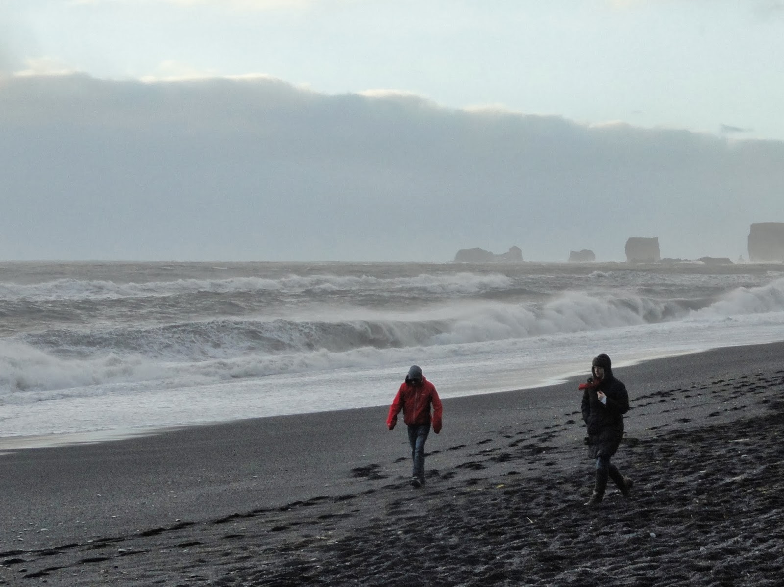
An entertaining James Patterson book on CD made the trip pass quickly and we made it to Vik with an hour of sunlight to spare.  Maybe it was the joy of seeing relatively clear skies, or stretching our legs after an atypically sedentary few days (not helped by the large breakfasts and constant snacking on Pringles, bagels, and candy…) but we really enjoyed Dyrolahey black sand beach and its cool caves and basalt columns. The wind was amazingly strong and we entertained ourselves by running with it (I was fast again!) and then against it (achieving the pace of a fast walk even at max effort).  We also spent some time watching the angry sea and exploring the area. It was lots of fun except for the occasional stinging stone projectile. 

Basalt columns on Dyrholaey Beach near Vik.

Very angry ocean and fierce winds.
Cool geology in the cave.

Fun times in 40 mph winds... until one of the little black rocks flung up and smacked me right as the picture was about to be snapped. 

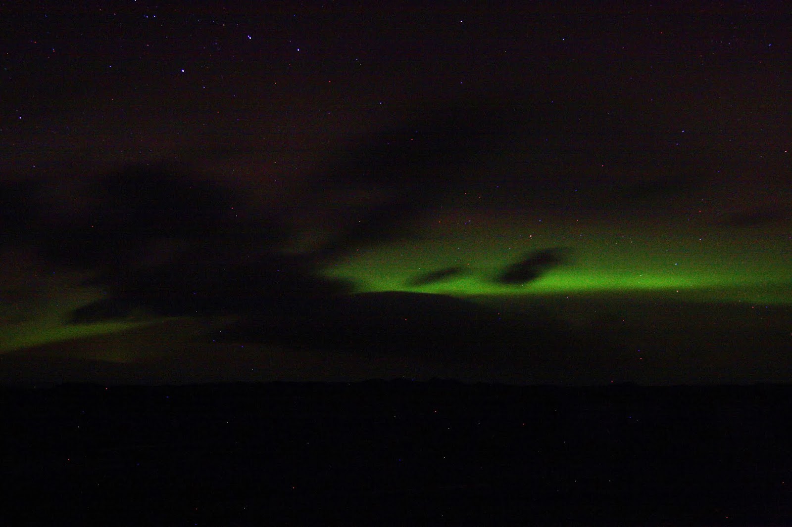
After the beach we headed back to our place to warm up with a shower, then joined a couple other guests for some tea and a chat.  We heated some soup for an early dinner and were ready to go searching for the Northern Lights as soon as darkness fell.   We ended up in a little rest area with a good view of the northern horizon, far enough off the main road to not be bothered by passing traffic.  Then we waited.  I’m not sure if it usually happens this way, but we saw the first wisps of the lights fairly early in the evening (around 7:00 pm) and they were just barely off the horizon.  By 1:00 in the morning they were visible all the way from the horizon to overhead.   And yes, we stayed out there looking at them for 7 hours!!  I think some people get lucky and see the lights without much work but for us it took a bit of tenacity.  The first few hours we saw underwhelming, very faintly green (almost gray, really) streaks that looked like clouds.  Honestly, the 25 -econd shutter speed we were using on the camera makes the green look more brilliant than it did in person for most of the time we were out there.  That said, the camera did absolutely no justice to the two-minute stretch of crazy light show we saw right at the end of the evening.  Chris happened to be outside of the car and started pounding on the roof.  I jumped out and looked straight up and saw at first some bright shades of green swirling slowly overhead that gradually turned into a brilliant kaleidoscope show.  Yes, it was two minutes out of the seven hours we sat in the car (again, thank goodness for James Patterson) but honestly it was so worth it! I hate to say it, but I feel a little hooked on seeing more of a show.  Maybe we’ll break the budget and go Lights hunting again this winter? 

Staying warm while snapping photos of the lights required a little imagination :)

The lights were just along the horizon in the earlier hours.  That bright spot is Chris holding a flashlight on himself for the 25 second exposure.  LOL.

Clouds in front of the band of light.

My favorite photo - maybe 10:00 pm?  Northern Lights with the Big Dipper.

Car drove by :)
Other than my trip home to see family in December, we literally have no other trips planned (for now).   It seems like the sun is setting on our string of crazy travel adventures.  As I get further and further along in this pregnancy (can’t believe I’m already 6 months along) we’re hesitant to venture too far from home and are looking towards the future.  There will certainly be more adventures, but for the next while they’ll be much more focused on the birth and rearing of a hopefully healthy and happy baby.  Boy and girl name suggestions and advice are always welcome, as are used baby clothes! 


Friday, October 25, 2013

20 down, 20 to go! Halfway to Tiny Schmidt.

Well after a few weeks of (again) feeling like this whole pregnancy thing wasn't really happening to us, we were glad to have our 20-week (aka HALF WAY THERE!) scan on Monday. I've attached the ultrasound of this beautiful baby. Okay, it really looks like a Halloween prop, but humor us!
 

20 week scan

12 week scan

Our ultrasound tech Diane was amazing. She literally showed us everything from the ventricles in Tiny's brain to the entire spine vertebra by vertebra to ten tiny fingers and ten toes. We know there's no cleft lip, no sign of Down's, the kidneys are working well and the baby is swallowing amniotic fluid like he should. She is totally average in terms of size and growth rate, which we're thrilled about. To my eye dork friends, Diane even showed me the lenses and orbital bones. My goodness.

Going against both of our Type A personalities, we decided to NOT find out if Tiny is a boy or girl. The tech put it well when she said "it’s like a Christmas present... part of you wants to know but it'll be so much more fun on the day if you don't!" Besides, both of us like the thought of having more gender neutral stuff in case we decide to go through this circus again someday.

We’ve been taking weekly belly pictures and all I can say is WOW, I underestimated how big I'd get! Chris has been so incredibly supportive and kind… I am so thankful for him.  I’ll occasionally catch him staring at my belly with his jaw open (how did you get this BIG?!) but I do the same so can’t really blame him. 

My first trimester food aversions are pretty much gone, or at least to the point that I can now be in the same room as an avocado.  More recently I have gone through some (thankfully short-lived) cravings.  The first was instant ramen noodles.   I was shocked to see their price had nearly tripled (40 cents?!) from  the time I was in school.  So much for your body knowing what you need, huh?  Surely that baby didn’t need 212% of my daily sodium and zero vitamins in one bowl of (40 cent?!) noodles.  The second craving was for kettle cooked salt & cracked pepper potato chips.  I rarely eat chips, and never that kind, so am not even sure how I realized I wanted needed them.  The lowest point, at least so far, was three weeks ago when I changed into yoga clothes for a 5 PM class, grabbed my car keys, and then thought   “I wonder how hard it is to make doughnut holes.”  Twenty minutes later I glanced at the kitchen clock just as it turned to 5:00; I was rolling just-fried doughnuts in a bowl of powdered sugar.   The worst part about this story (other than skipping yoga to make doughnuts) is that Chris had a flag football game and didn’t make it home at his usual time so I ate the whole batch.  Luckily for our health, I’m back to craving normal, nutritious foods.  Fruit, veggies, full fat dairy, meats, grains, and peanut butter are all back into the rotation, and that last package of ramen is sitting forgotten in a dusty corner of the pantry.

Over all, it’s really nice to finally like myself and not the low-energy nauseous blob of brain farts I was for a couple months there.  It’s amazing that something the size of a key lime sapped so much liveliness and productivity from me!  There were times I sat on the couch staring at the ceiling because I felt too tired to watch TV.  That’s pitiful.

During the first trimester we had to choose between two very different care options.  Since we’re military living in the UK we had the choice to have prenatal care and the birth on the British National Health Service (NHS) hospital two miles away from our house or to go to the American hospital on RAF Lakenheath, an hour’s drive away.  The choice was really tough and we still question our decision. We know and trust the military health care system but are interested in as natural a birth as we can handle.  In addition to being so near, the NHS system is midwife-based and has birthing options that range from an OB-led hospital clinic to home water birth by midwife.  Is that even an option in the States?  The Lakenheath system is much more structured, of course. An IV and heart monitors are placed at the start of labor and the rooms are much more comfortable, but the C-section rates are much higher and I’d be lying on a table for hours.   Everyone has put their two cents in about the matter, but since Chris and I were both born abroad by midwife we figure we’d keep the trend going! 

All my appointments and care so far have been by midwife and if the pregnancy continues in a normal fashion I may never see a doc.  My midwives Judy and Debbie are great and reassuring.  Their general stance is that pregnancy and birth are natural phenomena and that mammas need to relax.  They’ve basically said I can do anything I did before I ‘fell’ pregnant, just modified (run, but slow; bike, but at the gym instead of on these crazy roads, etc) The only things they have forbidden are downhill skiing and more than a half glass of wine a few times a week.  I can handle that!

Tiny is already pretty well traveled, and I can honestly say that people (men, women, teenage waiters) in Greece love pregnancy and babies the most.  We stepped out of a taxi at our guesthouse in the Greek island of Kos and within ten seconds the matriarch of the family came straight at me with her hands extended, speaking a million-word-a-minute Greek.  Before I knew what had happened her hands were on my belly and she paused from her Greek tirade to look into my eyes and shout BABY!  Mind you, I was only 15 weeks and could’ve just been carrying a few extra pounds!  What a brave woman. 

I think my mom is most excited for this baby.  Her nickname for me has changed from Claireabelle to Claireabellly.  
Friends here have been incredibly generous with maternity clothes donations.  Chris’ mom sent me a belly band that let me wear my own jeans and resist maternity clothes for quite a while.  Then I finally got around to ‘just trying on’ some maternity jeans my friend Angela had brought over.   The second that stretchy band went over my belly I realized I was never going to wear normal jeans again (or at least not for the remainder of the pregnancy).  Men and women should all own a pair of these things at least for Thanksgiving afternoon and the entire two weeks surrounding Christmas.  Just this week another friend Sarah brought bags full of cute shirts, jeans, and sweaters so I’m pretty well set on wardrobe for the foreseeable future.  
Moses basket - one of the many things Angela is letting me borrow for the next few months.
 
One more exciting piece of news is that as of this week I'm feeling Tiny’s movement!  It's marginally less strange than I thought it would be, although still seriously odd knowing there's an alien knocking about in there.  Chris was also able to feel a couple kicks – I’ve never seen his eyes get so wide. 
We haven’t come up with any names and are looking for suggestions.  We tried to get Uncle Calvin to help but so far he’s come up with “Bull” and “Peesa”, neither of which works too well with our last name! Let us know if you have any suggestions or any advice J This already has been a crazy adventure.

Monday, September 23, 2013

Iceland Part 2: Glacier Hike, Iceberg Lagoon, and the Golden Circle

After our few exciting days in Mývatn, we packed up the Chevy Spark and continued clockwise along the #1.  We were in for another long day of driving, but our first stop was less than an hour away.  We detoured off the Ring Road heading north through a lunar landscape to the waterfalls of Selfoss and Dettifoss.  The overnight temps had gone almost to freezing and it was a chilly mile walk from the car park (we were the only people there) to the cascades.   Dettifoss is truly impressive in its force and is said to be the most powerful (in terms of water volume) in Europe while Selfoss is a much more graceful waterfall coming down over the black basalt rock about a mile upstream. 

Deftifoss

Selfoss
A few more hours of driving later we were quite surprised to find that the #1 wasn’t actually paved the whole way around.  We drove at least thirty miles on gravel, a feat little Sparky handled much better than expected.  Chris, armed with a huge pack of Twizzlers and can of Pringles, handled the next five or so hours of driving with ease.  The #1 really does provide some beautiful scenery as it winds along the Eastern Fjords of the country.  We stopped to take photos of waterfalls and stretch our legs a couple times along the way, and made it to the Jokulsarlon Lagoon by late afternoon.

Waterfall along the drive.

The grocery store chain where we bought most of our food.  Why the pig with a black eye? 

Just one of the views from along the Ring Road.
Our car wasn't allowed on the interior F roads of the country (streams to traverse, etc).

This truck was allowed on F roads. :D
This lagoon is really interesting.  The #1 literally bridges over it, so it’s impossible to miss!  Jokulsarlon formed when the glacier at its mouth receded and saltwater from the ocean made its way in to the excavated space.  The saltwater, combined with the current warming period is melting the glacier around 200m a year.  As the glacier melts, it calves huge icebergs that drop into the lagoon and can float there for months before either melting or moving out to sea through the small inlet.  We stood on the edge of the lagoon laughing at the seals being cute and oo’ing and ah’ing at the seemingly fluorescent blue ice.  

Volcanic ash trapped in the ancient ice.


Denser, blue ice.
Our friends the Leach's advised us to also wander around the black sand beach at the outlet of the lagoon as chunks of ice that have been washed out to sea sometimes get pushed onto the shore with the tide.  It was pretty cool to play amongst the ancient ice.

Standing on the shore with the oversized ice cubes.

1000 year old ice!
One of our favorite bits of this trip was hiking half way up Falljokull (Ice Fall Glacier).  We were picked up from our campsite by a yellow school bus, which drove us the ten minutes to Falljokul.  We were handed a sandwich and juice box (appelsínusafa in Icelandic is orange juice, go figure), crampons, an ice pick, harness, and helmet, then hiked along what looked to be dirty gravel (which actually covered meters of ice) to what looked like the start of the glacier.  Falljokull  is an outlet glacier of the huge Vatnajokull ice cap that takes up 10% of Iceland, meaning it’s a slow river of ice coming down off the ice cap and melting into the sea.  The top two thirds or so of the glacier flows downwards (I forget, maybe a few meters a years?) while the lower third is actually ‘dead’ ice that is slowly melting.  This melting dead ice means the glacier is receding quite rapidly at 18 meters per year.  All of the outlet glaciers are receding at alarming rates, and it’s thought that in a hundred or so years there won’t be any left in Iceland!  You can see maybe 10 or 15 of these outlet glaciers from the southern part of the ring road, and Chris and I couldn’t help but be sad when we thought of their slow death. 
Standing on the glacier.

One of the outlet glaciers and its melt stream.
Our glacier guide Henrik (who was born in 1990… how are we so old?) clarified that there have always been periods of warming and cooling over time.  In the 1960’s the glaciers were larger than they were in the 1980’s, for example, the difference today is just how incredibly quickly the melting is taking place… faster than ever recorded. 
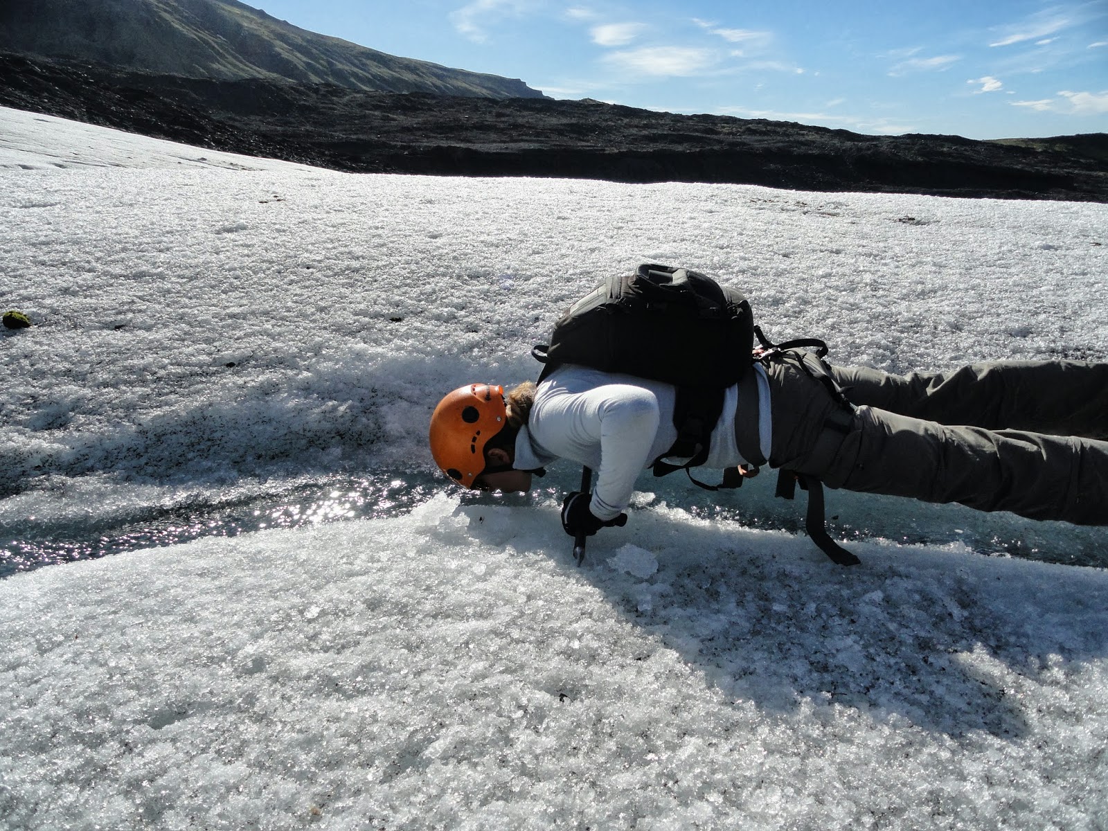
As I mentioned before this lower section of the iceberg isn’t moving, meaning we could sit in peace to put on our crampons and take off a few layers of clothes (the sun was warm!)  Armed with the spiky crampons, we moved in a loose line along the relatively flat lower section of the glacier.  Streams of clear melt water coursed through the ice, so our guide advised us to fill water bottles and showed us how to drink straight from the stream.   Henrik stopped us often to explain what we were seeing.  Once, about two minutes after explaining the dangers of hiking on some of the volatile uppermost parts of the glacier, we heard a loud boom and looked up to see an avalanche along one of the ridges (nowhere near us, don’t worry Grandma) .  It was an impressive sight, and I was suddenly feeling a little less adventurous!  Henrik cracked us up when he so eloquently told us “I’m trained to think of my customers as tennis balls.  I always have to look at which way they’d roll if they were to fall.” We were pretty sure that a tennis ball would’ve come straight down with all that rock and ice.
Stopping for a sip of water.

Chris armed with an ice pick.

Me glancing into an ice cave.

Should we have been jumping this? 

Chris and the rest of our group trecking along.
After our glacier hike we drove back to the Jokulsarlon Lagoon to take a boat through the icebergs that were constantly being calved from the Vatnajökull glacier.  The ice can be many different colors:  white ice is starting to melt, and less dense (the air bubbles within make it look white), black from volcanic ash, and pearly opalescent bright blue from really dense, non-melted ice.  Only 10% of any iceberg ice is visible on the surface, and we saw an impressive example of that when a seemingly small iceberg flipped over and exposed a huge section of its bright blue underbelly right beside the boat.  Even our boat captain, who must glide through the lagoon a hundred times a day, pulled out his cell phone to take some photos!  

Flipped glacier - the white part on the left used to be above the water while the blue ice to the right was underwater.

Strange ice shapes.
That night we stayed in a gorgeous guest house in Vik and the next morning came down to the most stunning breakfast.  On the massive wooden table sat fresh coffee and tea, homemade rhubarb and currant preserves, homemade bread and rolls, eggs, pancakes and juice.  Basically it was the best start to a packed day of sightseeing.  Our first stop was down the road a couple miles at the southernmost point of Iceland.  The black sand beaches were beautiful and had the sun been shining and the temperature quite a bit warmer we might’ve just scrapped the rest of our plans and stayed there for the day!  From there we started backwards on the quite famous Golden Circle route.  This route is great for anyone staying an overnight in Reyjkavic (for a layover on Iceland Air, for example) but honestly after seeing the rest of Iceland it just wasn’t as impactful as it would’ve been on its own.  The biggest contrast between the Golden Circle and the rest of Iceland was the seemingly vast number of people at the Circle’s three main sights: Gulfoss waterfall, Geyser (after which all others are named), and Pinglevir National Park, the other end of the Rift Valley we had visited in Mývatn.  
Vik's black sand and basalt columns.


Skogafoss

Seljalandsfoss

Geyser

The 'crowds' watching Geyser.

Gulfoss

Chris standig in the Rift Valley of Pinglevir National Park.  
Our last night was spent in Iceland’s capital Reyjkavic, where we were thankful to be warm and comfy in our room as the wind and rain absolutely raged outside.   This was the only evening we ate dinner out and weren’t really impressed.  So, with a sample size of only one, to us, the food in Iceland wasn’t worth the money.  We’re returning to Iceland over Thanksgiving weekend to try to catch the Northern Lights so may explore more of Reyjkavic then but for this trip we were content to spend a quiet night and catch our plane the next morning. 
So was it worth it?  ABSOLUTELY.  This may have been my favorite trip so far, and Chris said he feels the same.  All you Seattle folks should take advantage of IcelandAir's layover opportunity to Iceland if you ever get an urge to visit Europe!